1. To describe water quality in all participating lakes in terms of trophic status.
2. To Monitor for changes in water quality over time.
3. To educate the public about lake ecology and water quality issues.
The LMVP was created in 1992 beginning with four lakes in the Kansas City area. The program is funded by the U.S. Environmental Protection Agency through the Missouri Department of Natural Resources and coordinated by the School of Natural Resources at the University of Missouri.
The LMVP is interested in measuring lake trophic status; measuring the amount of algae in lakes and investigate the factors that regulate algae growth. Algae supply dissolve oxygen and food for aquatic animals. Too much algae can cause problems although some algae are necessary for a healthy lake. Some of the problems caused by too much algae include a decrease in aesthetic beauty, disagreeable odors and taste in drinking waters. Changes in temperature and oxygen structure of the lake can affect aquatic life so measuring the photosynthetic pigment chlorophyll estimates the amount of algae in the lake.
The levels of nitrogen and phosphorus are also monitored as these two plant nutrients are often the limiting factor in algae growth. Lakes with the highest nitrogen and phosphorus concentrations have the most algae. Although these two nutrients occur naturally in Missouri Lakes, they often do not cause problems until human influences lead to increases.
Inorganic suspended solids are sampled on some lakes. These materials consist mostly of soil particles that have entered the lake as erosional runoff from surrounding land. Excessive soil materials in a lake can turn a lake turbid and give it a brown color. As the materials settle out of the water, they fill the lake bottom. Soil particles often have nitrogen and phosphorus bound to them so if large amounts of erosional inputs flow into a lake, nutrient levels can be elevated. A tool called a Secchi disk measures water clarity.
 |
| Well-Equipped LMVP Volunteer includes logo hat, T-shirt, jacket/vest, and... |
 |
| ...watercraft of personal choice including logo flag and water sampling equipment. |
1. Making field observations on assigned lake and record on a Data Sheet provided every three weeks beginning in April and ending in September. A calendared three-day window schedule for each lake is provided.
2. Collecting and processing lake water samples and recording information on the Data Sheet. Specific sites are designated and labeled for all data collected and recorded.
3. Proper storage of samples and equipment to be transferred to LMVP staff member for analysis at their limnology laboratory at the University of Missouri in Columbia typically picked up at volunteer's home two times per season.
I have completed my first year as a LMVP volunteer which began in April of 2015. As a Missouri Master Naturalist with the Lake of the Ozarks Chapter, I am required to completed at least 40 hours of volunteer service per calendar year. This activity is considered "Citizen Science" and I report 5 hours every 3 weeks which includes the 3-4 hours of Data Collection then another hour for in-home lab work. There are 40 hours with that project alone. Other activities I do regularly in season are the Missouri Frog & Toad Calling Survey on Stockton Lake and Kayak Meet-Ups on Lake of the Ozarks which combined is at least another 35-40 hours. There are numerous other nature-related projects available for volunteers in addition to meetings and social activities.
My assigned LMVP Service project includes two designated sites on Pomme de Terre Lake:
Site #1 is located close to the dam between the island and P-1 which is towards the west side. I put-in and take-out my kayak at the Overlook Picnic Area which is about 5 miles from my home in Hermitage. It is about a mile to the first sampling site by kayak.
Site #2 is located off the Wheatland Park Boat Ramp which is at P-5. A roundtrip is 10 miles and this is where I turn around and return. It is all flat water paddling. I average 2.5-3 miles per hour depending on the wind and direction it's blowing; 3-4 hours unless I stop for a swim or visit with the public.
 |
| U.S. Army Corps of Engineers Pomme de Terre Lake Office at the Dam |
 |
| Loading and unloading my 75 pound 12' Wilderness Tarpon Kayak is easy when you have wheels. |
 |
| Wheels are an essential part of my equipment. |
 |
| Training Day in April 2015 with LMVP's Tony Thorpe who chose a windy, cold day to break in the Newbie. |
 |
| My Maiden Voyage with Secchi Disk in hand. |
 |
| View of the Overlook Picnic Area where my car/trailer are parked taken from my kayak showing high water in July 2015 covering the playground. |
 |
| This is the turn around point at Wheatland Park Boat Ramp during the high water level time in July 2015. The ramp and signs are all under water. |
 |
| Returning to the Overlook Picnic Area after about 10 miles of high times in rough water July 2015. I was actually having fun riding the waves in with the wind at my back! |
 |
| Water level is back to about normal by August 2015. In July, the water level almost covered this mile marker sign! |
 |
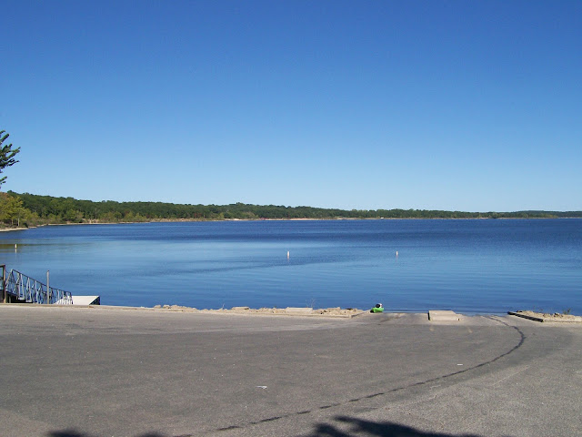
| August 2015 - Here is the Wheatland Park Boat Ramp where Site #2 is located in the middle of the water. I am standing about where the water level was in July 2015. |
 |
| Calmer waters and normal levels in August 2015 as I return to the Overlook Picnic Area. |
 |
| Most of the time I see eagles...or are they watching me? |


